
Website · ▶ Watch the 52-second film · GeoVerse Live brochure · SDK playground · Line Finder playground · 中文
GeoVerse Labs builds a composable toolchain for spatial applications — from geometry persistence and tile serving to dual-engine rendering and editing, a collaborative editing platform and an AI-native runtime. Every layer works on its own; together they take a spatial app from the database to the browser, and hand it to AI.
| What it is | Status | |
|---|---|---|
| GeoVerse SDK | One mapping API on OpenLayers or MapLibre GL. Chinese basemaps (GCJ-02 / BD-09) corrected inside the engine while your coordinates stay WGS-84; a framework-agnostic editing engine (25 commands, undo/redo, three-way-merge sync); official Vue and React bindings. | Commercial · early access · playground ↗ |
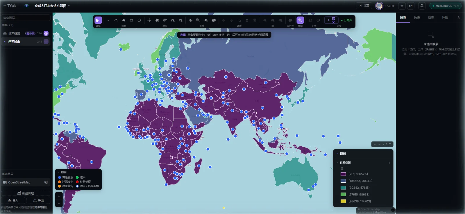
| GeoVerse Live | A collaborative geodata editing platform built on the SDK: switch engines per project, version history, thematic mapping, real-time co-editing and comments, an AI assistant that works on the current layer, and login-free sharing / embedding. | Private · brochure ↗ · demos on request |
We publish the building blocks we think the ecosystem needs — open source or source-available — separately from the core SDK:
| Repo | What it is | License | Get it |
|---|---|---|---|
| geoverse-line-finder | Zero-dependency TypeScript routing on GeoJSON networks: A* / Dijkstra / ALT, snapping, multi-waypoint, multi-level indoor routing. Playground ↗ | Apache-2.0 | pnpm add geoverse-line-finder |
| geoverse-map-server | GeoVerse Serve — a single pure-Go binary that publishes PostGIS, MySQL, PMTiles, MBTiles, GeoJSON and GeoPackage as MVT, WMTS, OGC API – Features and MCP | MIT | make build |
| geoverse-sar | GeoVerse SAR — AI-native runtime for spatial apps: UI, AI tool calls, agents and MCP clients share one governed kernel (technical preview) | MIT | build from source (geo packages need GeoVerse SDK access) |
| mybatis-plus-geometry | Spring Boot starter bridging MyBatis Plus and JTS geometry types (MySQL / PostGIS) | Apache-2.0 | Maven Central 1.0.1 |
| geoverse-skills | Spatial skills for AI agents — deterministic region layouts for racks, bays and booths, with an MCP App | BSL 1.1 (source-available) | @geoverse/layout-mcp-app |
- Contracts before implementations — coordinates are always WGS-84 at the boundary; the editing core never sees a map library.
- Gates, not conventions — dependency direction is enforced by lint gates, cross-entry parity by tests.
- Four-tier status — implemented → verified-in-clean-CI → published → production-supported. We say which tier, not "done".
- Reproducible numbers — benchmarks report medians and ranges over multiple rounds, with pinned competitors and a repro command.
- Licensing / early access / demos (GeoVerse SDK & GeoVerse Live): libra.liuyb@gmail.com
- Issues & contributions: open an issue on the relevant repo above
- Press, talks and logos: brand kit & boilerplate copy
